By Ivan Viehoff
The main attraction of Chile to the tourist, cycling or otherwise, are its well-managed national parks, the best preserved natural environments of South America. Here you can find true wilderness and a great variety of scenery from utterly rainless desert to impenetrable rainforest. Austral Chile (XI Región or Aisén) is one of the most wonderful cycle tour zones in the world, though you need a bit of luck with the weather. Outside the wilderness areas, some of the rural farmlands and coastlands have considerable charm. However paradise is far from continuous, and in between these idyllic retreats are busy main roads, flat boring farmlands, monotonous monochrome deserts and many uninteresting towns. But efficient and surprisingly cheap transport is available to carry you and your bicycle between the beauty spots. These notes are based upon a total of 4 months cycle-touring in Chile in 1997/8.
Difficult
road along Lago Carrera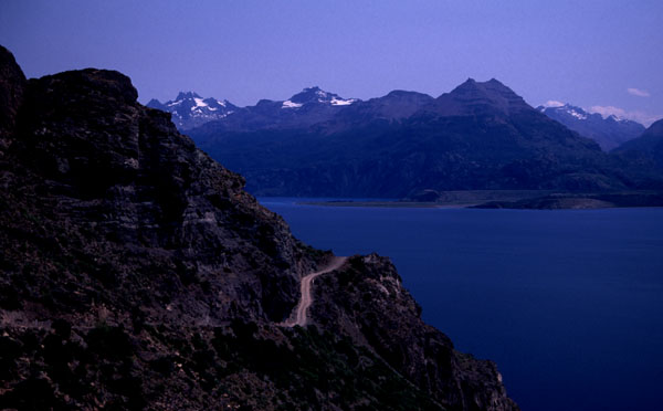
Chile has a developed network of excellent paved roads, and the paved network is being rapidly extended. As far as I could see, all roads are open to bicycles, though you would not necessarily wish to cycle far on major dual carriageways. Some tunnels are closed to cyclists, but the guards will take you through in a van or you can hitch. In roadworks, which can last for extended distances, it is normal for traffic to be diverted onto a parallel rough track, but cyclists can usually ignore this. The paved network is rather trunk and branch in structure and most link roads required to complete a circuit are still unpaved. Most Chilean unpaved roads are utterly dreadful. Over-used and under-maintained, they are among the worst roads I have ever cycled. For extended distances on Chilean unpaved roads, you need the strongest panniers and racks you can find, preferably steel racks; aluminium low-riders in particular are a disaster, as many cyclists I met can testify. Fortunately a few unpaved roads of special interest to cyclists appear to be more regularly maintained, in particular the Carretera Austral from Chaitén to Puerto Aisén (only), and roads in Magallanes (XII Región) are not as dreadful as the rest. If you can, it is best to avoid riding on unpaved roads in the rain. Chilean drivers are better than in other South American countries, though that is not saying much so keep your eyes peeled. Signposting is generally adequate, though you need a good city plan to find your way around Santiago. Most city streets are one-way. It is usual to cycle on the left hand side of one-way streets, as it keeps you out of the way of the buses.
Chile is 4 hours behind GMT and daylight saving is observed from the second Saturday in October to the second Saturday in March. This puts sun overhead at around 13.45 in summer and 12.45 in winter, giving long evenings in summer, and light until at least 6pm most places most times. At Arica, daylight hours vary little during the year, whereas Punta Arenas shows a summer/winter variation of 16 hours to 8 hours similar to England.
The best maps available for cycling are in the Turistel guides published in three volumes, Norte, Centro and Sur, updated every year. Each volume includes a small road atlas for the area it covers, which is better than any other commercial map, excellent town plans, regional plans of areas of particular interest, and, a treasure trove for those who can read Spanish, detailed route descriptions of touring routes. Unfortunately there is no relief. There are many misprints on the maps, though they correct a few each year. Routes shown in white vary from passable with care to optimistic; those shown as dashed are usually fantasy. The 1991 edition was also published in English in a single blue volume, with the title Chile A Remote Place on Earth; whilst this is in many ways the best available guidebook to Chile in the English language, the maps are showing their age. Turistel also publishes an annual pocket-sized road atlas, though the maps are less detailed. Chile does have a military survey, but maps are only available at their offices in Santiago, and are terribly out of date - of more use to walkers than cyclists. The regional Ministry of Works also produce some interesting maps if you can work out how to find them. The Lonely Planet guide to Chile available in 1998 is very inaccurate, and the South American Handbook appeared rather better. However the walker will probably be pleased with Lonely Planets Trekking in the Patagonian Andes (2nd ed).
Most small towns in Chile have somewhere simple and relatively cheap you can stay, though in general accommodation in Chile is expensive in relation to what you get. Backpacker hostels exist only in Santiago and a few major backpacker destinations in the south; these are not generally used by chilenos. Reasonable accommodation is harder to find in industrial cities off the tourist trail (eg, Concepción). Two accommodations are particularly recommended for cyclists. In Villarrica, Swiss cyclists run the Torre Suiza hostel. (I have read recent reports of something similar near Malalcahuello in the Araucanía.) At Los Andes 80km north of Santiago, French cyclist and vet Eric Savard keeps open house for passing cycle tourists - look him up at his surgery at OHiggins 178, Los Andes (034-422322).
Organised campsites in Chile are mostly aimed at chileno family groups. To the foreign tourist they seem like a rip-off: basic, expensive, and usually closed outside the Jan/Feb summer holiday season. Since most charge per family group, if you are a couple or less you will often do better to find a simple guesthouse. In thinly inhabited parts of Chile (north of Santiago, south of Chiloé), wild camping is fairly easy and often essential. Wild camping is prohibited in national parks, but Conaf (the parks administration) provides camp sites - some are free, some are absurdly overr-priced. From Santiago to Chiloé much of the land is heavily farmed and fenced, so wild camping is often difficult; other cyclists say that they were able to camp on farms but I had a less happy experience. Information on campsites published by Turistel is unreliable, but their maps do show a few traditional wild-campsites with a white tent symbol. Put your rubbish out of reach or you will be disturbed by foxes. Making camp-fires is a traditional part of chileno camping, though gathering firewood is now banned in a few of the more heavily visited national parks.
Stove alcohol for Trangias is widely available. White gas (bencina blanca) is cheap and widely available from ferreterías, but filter it as it often has a little grit in it. Gas stove users may have problems with compatibility of local bottles, but you can buy a local burner cheaply if you have to. A camp-fire is often possible, but not in Torres del Paine or the Atacama desert.
Food is available in most villages. You can often get supplies on Sundays in larger settlements. Outside the Santiago to Chiloé zone, sufficient food-carrying capacity and careful supplies planning is essential because of the distances between settlements. In Magallanes and the Atacama, it is essential to be able to carry sufficient water to camp overnight and ride on the next day; given the dry and windy conditions, this means a carrying capacity of at least 10 litres per person - I occasionally used 15 litres before restocking. Ortlieb waterbags are recommended.
When crossing the border into Chile, there are important restrictions on the food products you are allowed to carry in. This can require careful planning, as sometimes it is a long way to the first shop. You are not allowed fresh fruit or dried fruit, fresh vegetables, fresh or cooked fish and meat products unless tinned, fresh milk products, nuts, unprocessed seeds, or honey. In essence, you are restricted to canned goods, dried milk, bread, cake, biscuits, pasta, rice, oats, flour, sugar, oil, etc. The things they are most worried about are fresh fruit and veg, meat, milk and honey. Cyclists who didnt speak much Spanish told me they were always searched. I always said I only have tins and dry food, denied everything else, showed concern and understanding, and I was never searched. There is also have an internal food control boundary with the same restrictions when travelling south out of the Atacama.
There is no shortage of bike shops stocking basic Chinese parts. Nice Shimano parts are more scarce, but can be found in wealthier cities and up-market tourist towns like Pucón. Bike repair is often a separate business, and service is usually cheap, efficient and attentive. All the latest Shimano is available in Santiago on San Diego in the 800 block about 1km south of the Alameda. It's not cheap, but sometimes you can bargain. Another good place is Arica, try Wilsons a few blocks east of the bus station. If you need new tyres or rims, you will have best luck if you are on 26" as mountain bikes are now widespread; local roadsters tend to be 27", and 700C (28x1 3/8) is limited to racing equipment. Perhaps as hybrids become more popular this will change. Whilst you can find high quality mountain bikes and components in Chile, what you cannot find as yet are touring requirements (racks, panniers, high quality slick tyres) of sufficient robustness to put up with Chilean roads. Nor can you find tents, etc, which are adequate for Chilean weather conditions away from the beach. There are no frame-builders in Chile, though there are general welders of considerable skill, particularly in regional towns remote from Santiago - I found a genius in Coihaique who can weld aluminium with an oxy-acetylene torch. I have heard of people getting general metal-workers in to knock them up a steel luggage rack, though of course you will have to design and specify it! The nearest frame-builder is the exceptional Miguel Nitzsche just over the border in Bariloche, Argentina (see my Argentina notes).
If you intend riding the rough roads of the south, you need the highest quality panniers (eg, Ortlieb) and steel racks (eg, Tubus steel racks). Even steel racks will break, especially your front one, but it is easier to get a steel weld. Carry a pile of little nuts and bolts, duct tape, cable ties, etc, (all locally available), to repair breakages - expect all of your pannier rivets to fail eventually. If you have any ambition, you are going to get to some places on terrible roads quite remote from civilisation, so the following really ought go without saying: basic tools, spare tubes and tyre, puncture repair, cables, brake blocks, a bit of chain oil (car engine oil is fine), bearings grease and cone spanner, spare chain link, sprocket extractor, spoke key and spokes sized to your wheels, crank extractor, chain extractor. Also carry anything "hard-to-find" which you need for your particular bicycle, eg I carry spare axles and chain rings. Most bike repairers do not have headset tools, so consider taking a Cool Tool headset "end" for an emergency. High quality tyres are a rare find, so if you are fussy take some spares. An altimeter, cycle computer and compass are useful assistance in navigation and assessing progress. Weather in the south can be both very wet and extraordinarily windy, so you need to be confident of your tent and your ability to put it up in a force 10 storm; take a couple of spare pegs and a pole repair. Nights can be surprisingly cold in many areas, including the desert north, so take an adequate sleeping bag; a silver "space blanket" is a cheap and light way of adding a couple of seasons to a sleeping bag.
Tap water can be drunk almost everywhere - the only exceptions are in small settlements in the deserts (including Patagonia). In the forests of the south, where there was no agriculture up-river I always drank untreated stream water; however I am told that this is now becoming less safe in places receiving larger tourist volumes, eg, Torres del Paine. Chile takes food safety as seriously as many European countries, so food can be eaten without worry, with the following two exceptions. First, do not gather shellfish yourself as it can be contaminated by a deadly toxin (see discussion of Red Tide below). Second, many small grocers are unaware of the need to refrigerate fresh milk products such as fresh yogurt, so only buy long-life milk products unless you are in a large supermarket. Raw fish products such as ceviche and fresh oysters can once again be legally found in restaurants, following an earlier ban because of a cholera outbreak, but it would be wise to have Hepatitis A vaccination.
You should be aware of precautions to avoid two exceedingly rare but deadly diseases, red tide and hantavirus (see below). Altitude acclimatisation must be taken very seriously in northern Chile (see below). Chagas disease is present in the northern part of Chile - beware of accepting overnight hospitaality in primitive dwellings in this area (see my Bolivia notes for more detail). Fleas can be a problem - if you get persistent multiple bites day after day, it is more likely to be fleas than bedbugs. To get rid of fleas wash yourself and all your clothes and bedding, and hang them out in the sun; to discourage unwanted passengers keep mothballs in your luggage. The Chilean sun is very strong, especially in the south because of the ozone hole; high factor sun lotion and lip protection is widely available ("baby" brands can be cheaper), but you may wish to take a sweat-proof "sport" brand from home for use on your face; a broad-brimmed hat is advised. In mid-summer tábanos (horse flies) are a serious pest, especially in the Lake District and Austral Chile; they hunt in packs and are very persistent. In late summer, there are large numbers of wasps. Bees are africanised and should not be disturbed. Mosquitoes are a nuisance in a few places, but they dont carry any nasty tropical diseases. Leeches are a nuisance on little-used trails in dense rainforest.
In northern Chile, the passes to Argentina and Bolivia are all around 4,500m. Rapid ascent to this kind of altitude makes most of us ill, and some of us might die. Adequate time for acclimatisation is essential, and only you can know, from prior experience, how much time you need and at what altitudes. For myself, I try to provide a day for every 300m of ascent starting at 2,700m. Others need less or more. The most important consideration is what height you will sleep at. You can ascend several hundred metres higher than your target altitude for the day (indeed it is a good idea to do so) provided you descend again to sleep. Extra time spent at an intermediate altitude does assist somewhat in acclimatising to a higher altitude. Cyclists and walkers need to take much more care over this than bus-travellers, because heavy exercise is more likely to provoke unpleasant symptoms from your lack of acclimatisation than being sedentary. Drinking a lot of fluid helps. But even when you are thoroughly acclimatised, things are always a lot more effort at altitude. Coca tea or chewing coca does not assist in acclimatisation. It acts as a mild painkiller, and suppresses feelings of thirst, hunger and tiredness. Fair enough for sitting in your tent at the end of the day. But I would say that you if you suppress these "messages" from your body while you are active, then you risk overdoing it. By chewing coca with the locals, or using coca leaves as gifts, you will get a better social connection with them - but don't carry large quantities or take it across borders. But if you use it while exercising, then try to have a separate understanding of your body's limits.
The Chilean side of the major Andean passes leave little time for acclimatisation, since they have a rapid climb with few obvious stops on the way. Then you arrive on a plateau, so there is little immediate descent. These are not routes suited to a voyage of medical self-discovery. If you do not know how your body responds to this kind of altitude, it would be advisable to find an alternative route which allows more opportunity for acclimatisation, and more provisioned places to stop if you need to. Some of the climbs to the high Andes in NW Argentina and Bolivia are both more practical in terms of acclimatisation and arguably more rewarding in terms of culture and scenery.
Shellfish is the culinary delight of Chile, but there is a very small but potentially fatal risk. The seas of Austral Chile and Magallanes from time to time produce the "red tide" plankton which makes shellfish in the affected areas deadly poisonous, whether cooked or raw. In summer 1998, red tide zones were found throughout Magallanes and Austral Chile, almost up to Chiloé. All shellfish sold in markets is tested and is safe. You must not gather shellfish to eat yourself. If you collect and eat shellfish in a red tide zone, you will probably die. It is also inadvisable to buy shellfish in small settlements remote from testing facilities or medical attention. Severe symptoms usually start after about 20 minutes after eating affected shellfish; medical attention (which is normally effective) must be received within about 2 hours or death usually follows. Effective control has kept cases exceedingly rare. If the other diners in a seafood restaurant are still alive, its a good sign.
A lot of rubbish has been written about hantavirus, even in reputable guidebooks. Hantavirus, runs the myth, is rampant in Patagonia. In truth you are far more likely to die in a road accident than contract hantavirus. The myth arises because from time to time there are little outbreaks, and most recently this occurred around Coihaique in Austral Chile and El Bolsón in neighbouring Argentina. In fact there are rare isolated cases all over the Americas, including the USA, but because the symptoms are similar to pneumonia and the incubation period is 4 weeks, it is often overlooked. The disease is transmitted in the excretions and bodily fluids of the long-tailed mouse (ratón de cola larga), but the agent is killed by bleach or by 30 minutes exposure to sunlight. The Patagonian outbreaks occurred because unusual ecological conditions brought on a mouse plague in areas with many holiday cottages. People entering their cottages for the first time in the season disturbed mouse faeces in dark corners and inhaled the dust. Hantavirus is easily cured if identified early enough - if you have flu symptoms with a lot of phlegm, go to a doctor and mention the possibility of hantavirus. Once the disease develops fully, the survival rate falls to 50%. To be prudent the following precautions are advised:
Dogs are a nuisance in Chile, particularly on quieter roads in the south. The locals throw stones at dogs which are annoying them, including their own dogs, and would be surprised if you did not do likewise. Some cyclists carry a dog-stick - lift a stout stick into the air and most dogs will quietly slink off.
Chile is probably safer than many European countries. You need to look after your belongings as you would in England, particularly in the cities, though in the countryside you can be very relaxed. A local was most offended I should think to lock my bicycle in a small country town, though Santiago is another matter. The risk of violence is in general low.
The Chilean currency is the peso, written $ or CH$. In mid-1998, there were around CH$ 460 to the US$. It is a fairly soft currency and has recently tended to devalue by about 10% a year. The only foreign cash worth holding in Chile is US$, everything else is changed at a poor rate; if arriving from another country change your excess into US$ before you leave. Unlike some other South American countries, it is not common for traders to accept US$ in payment. US$ travellers cheques are widely accepted, though rates deteriorate the further you get from Santiago. (It is impractical for non-residents to purchase travellers cheques in Chile.) Bank machines taking Visa are widespread; a few machines take MasterCard. Because of the softness of the peso, major transactions, eg air tickets, are often priced in US$ and either converted to pesos at the time of the transaction or paid in US$.
Chile is not a cheap country. Prices are a bit higher than New Zealand, but your expenses will be inflated because of the difficulty of finding self-catering accommodation. The typical price for basic accommodation in 1998 was CH$ 4,000 (per person), a camp site (per tent) costs at least as much. Unless there is a seafood market, eating out often isnt terribly cheap, exciting or suitably nutritious for the cyclist, so its worth trying to stay in places which will let you cook for yourself with the excellent ingredients which are usually available (or set your camp-stove up in a quiet corner). However bus travel is cheap - Santiago to Puerto Montt (1,000km) by bus cost about CH$ 6,000, though prices are somewhat higher in northern Chile. Travel via Argentina, often necessary south of Puerto Montt, is expensive. Internal air tickets often have fixed prices, so you wont necessarily save money by shopping around. Chile is the cheapest place in South America for telephone and mail service, but for some reason it was difficult to find cheap telephone calls in Santiago in 1998. International calls from Chile are cheaper than national ones in Argentina.
Chile has widespread, efficient, cheap, regular, comfortable bus services. Most will take bicycles for a modest charge if you check in advance. Shop around as prices (and qualities) vary. I found LanChile a most bicycle-friendly airline; I checked in 15kg plus bike on many flights with no surcharges; only once was I asked to wrap the bike in a plastic bag. It is best if you can stuff all your panniers, etc, into one bag, as some flights use the "two piece" system. Some of the ferries have stiff bicycle charges: see detailed comments below. In 1998 the passenger train network was reduced to two lines, Santiago-Temuco and Calama-Uyuní (Bolivia), and may carry your bike if you are lucky. In remote parts of Chile, particularly where the roads are unpaved, the prospects for getting a hitch are quite good, as people generally drive pick-ups (camionetas). I was sometimes offered unsolicited lifts.
One of the best ways to Chile, especially the south, is to fly to Buenos Aires, fly or bus across Argentina, and then cycle across the border: the Andean crossings are often the Best Bit. LanChile/Air New Zealand offers the amazing Auckland-Tahiti-Easter Island-Santiago service, but its not cheap. Another interesting antipodean route is the Aerolineas Argentinas/Air New Zealand Buenos Aires-Río Gallegos-Auckland service; currently the Río Gallegos stop (60km from the Chilean border) is only made on the way to New Zealand. Penguin-lovers can fly from RAF Brize Norton to Mount Pleasant on the Falkland Islands (twice weekly), and then either fly on to Punta Arenas (once weekly on Saturday), or splurge on an Antarctic cruise from Port Stanley to Punta Arenas or Ushuaia. (See my notes on cycling in the Falkland Islands.) When crossing the border from Peru or Bolivia, in principle you are subject to a compulsory baggage search. In 1998 at Lago Chungará (La Paz-Arica road) they did not have a mechanism for enforcing this on cyclists, so I got away without it. See "supplies" above for restrictions on the food you may bring in.
Each entry to Chile gives you 3 months, with no restriction on re-entry. The airport is 20km NW of the town centre, just outside the orbital road Calle Americo Vespuccio. 1998 saw the link road from the airport to the orbital rerouted. It now joins the orbital south of the Mapocho river and just 2km north of the Valparaiso turn. (Some maps show a direct route to town following the river Mapocho, but it doesnt exist.) To get to town, head south down the orbital to the Valparaiso junction, where you have a choice of two unpalatable left turns. For me, the better choice is the second, which is the main dual carriageway coming in from Valparaiso; at least there is a hard shoulder and not many traffic lights until you get close to the town centre; this road leads straight onto the Alameda (alias Avenida Libertador Bernardo OHiggins). The other option is to go sharp left up Calle San Pablo, which also leads directly to town (without changing its name); on this "minor" road, eventually the width of a motorway, you will contend with traffic lights every 100m and innumerable local buses poisoning and cutting you up at each one.
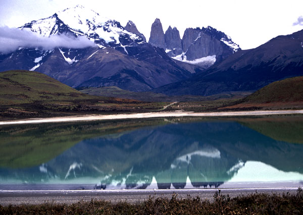
Cuernos del Paine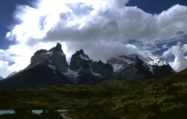
Despite the almost unendurable winds, the far south is popular with cycle tourists, because of the access to the wonderful Parque Nacional (PN) Torres del Paine and Tierra del Fuego. Personally, I find even the steppes in between the mountains rather attractive, especially in the sun, though others find them a bit boring. Iceland-lovers will be in their element: summer maximum temperatures are typically about 16C, frosts are possible almost all year. When the sun comes out, visibility is extraordinary because of the clearness of the air, and there are amazing skyscapes. But overcast conditions are common. Rain turns to snow above about 500m all year round. Rainfall is modest, except in the western areas of Torres del Paine and the south of Tierra del Fuego, though expect 3-minute squally showers at any time. Winds are generally from the west and frequently very strong, especially in Tierra del Fuego and along the road to Río Gallegos. From time to time the wind is so strong you cannot cycle into it, and it is preferable for this reason to cycle in the direction Puerto Natales to Punta Arenas, Porvenir to Ushuaia and Punta Arenas to Río Gallegos. Predicting how long a journey will take is hard because of the wind factor. Midsummer is attractive because of the long daylight hours, especially December before the hordes get there. However March/April can also be wonderful as the gales die down and the sun breaks through more regularly. In winter there is often lying snow. An El Niño year seems to provide more extended periods of calm and sunshine than a normal year, though it also brings a bad spring and higher rainfall.
Supplies are only available at Punta Arenas, Puerto Natales, Cerro Castillo, Punta Delgada (the village, not the ferry terminal), Porvenir, Cerro Sombrero, Cullen and Puerto Williams. Additionally, simple supplies at absurd prices are available at various points in Torres del Paine. There are also a few cafes on the main roads. In Argentinean Tierra del Fuego, supplies are available in Río Grande, Tolhuin and Ushuaia (only).
Apart from the Torres del Paine area and the south of Tierra del Fuego, surface water is scarce and often saline. On the Punta Arenas/Puerto Natales road, estancias where you can ask for water are infrequent to the south of Morro Chico. There are fairly regular estancias in Tierra del Fuego, but many are well set back from the road and have "dont even think about coming up here" signs at their entrances. It is wise to carry sufficient water for an overnight camp in this area. Do take your own water if you wish to camp near the Seno Otway penguin colony - the wardens get theirs by road and cannot afford to give it to visitors; the puesto by the road junction can give you some, though it needs treating.
One of the most popular ways to get there is on Navimags Puerto Montt-Puerto Natales ferry. If you think of it as a three-day cruise, it is cheap, but as pure transport it would be cheaper to fly. Conditions for passengers have improved from early days, but its still a bit school dinners. In 1997/8, the trip was around US$320 (full board) in a cabin or US$200 in a dorm (económico), cheaper off-season. Check out the latest prices on their website www.australis.com/navimag. The disadvantage of económico is that many people are seasick on one section. Económico can only be purchased at departure ports; cabins can be booked in Santiago or other Navimag offices. Off-season, if you pay económico you will probably be put in a cabin. Advance booking is essential in the Jan/Feb peak season, though stand-by is often available to determined queuers, especially travelling in the northerly direction. There is a moderately stiff bike charge, but unless you remind them of it they may forget to collect it. You can stop over in Puerto Edén for a week, home of the remaining few Qawaskar indians but take a few books to read. Don't forget your binoculars for the albatrosses and dolphins.
Icebergs in the southern fjords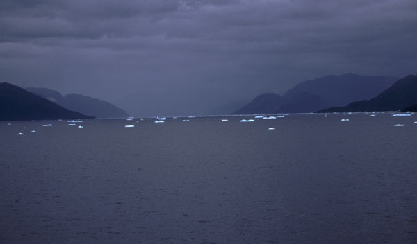
Navimag has just introduced a new ferry (more likely a new second-hand ferry) called the Magallanes, which is running from Puerto Montt to Puerto Natales via Puerto Chacabuco. This provides the much-needed direct connection between Austral Chile and the far south. It seems to be the same price as the Puerto Edén, but you pay about two-thirds the fare for the part journey.
The Punta Arenas-Porvenir ferry is once daily, takes 2 hours, and is cheap (times vary so check). The Punta Delgada crossing should run every half hour, but suffers regular interruption from low tides and strong winds; it is cheap (and scary). Two or three times a month, a ferry runs from Punta Arenas to Puerto Williams for an astonishingly cheap price of CH$16,000 (1997/8). There is only a handful of passenger spaces, so it is hard to get on in the Jan/Feb high season, but youll have it to yourself out of season. If you are lucky with the weather, and it isn't the middle of the night, the views on the way are incredible. It takes a couple of days, but is prone to considerable delay because of the weather. You can also fly there. Puerto Williams is an amazing place to visit, especially for the walker. The short hop from Puerto Williams to Ushuaia is currently a serious pain because the regular ferry was discontinued and yacht owners expect about US$50-60 to take you. Navimags Punta Arenas-Ushuaia "service" is an expensive luxury cruise. Punta Arenas is also a major departure point for Antarctic cruises, some of which start or end at Port Stanley. There are often backpackers hanging around the port hoping for a last minute cheap deal.
There are flights from Punta Arenas to the Falkland Islands once a week; the airline changes from time to time so check with each airline individually. At time of writing it goes on Saturday with LanChile. From October 1999 there is a stop in Rio Gallegos once a month (3rd Sat eastbound, 4th Sat westbound).
Transport between Austral Chile and Magallanes is not as convenient or cheap as other parts of Chile. In 1998 the only direct flight was a small aircraft from Puerto Natales to Coihaique town airport. Otherwise you will have to go the long way round from Punta Arenas to Balmaceda via Puerto Montt, which will not be cheap. The new Navimag Magallanes ferry from Puerto Natales to Puerto Chacabuco fills a much needed hole in the market, but purely as transport it is probably more expensive than flying. Not so far away, there is a once weekly Argentinean flight from Calafate to Perito Moreno (the town not the glacier). There is a once weekly direct bus service from Punta Arenas to Coihaique, which books up rapidly, and isn't cheap; but you can go daily in three stages (and more cheaply) by booking separate tickets via Río Gallegos and Caleta Olivia (for Los Antiguos/Chile Chico) or Comodoro Rivadavia (for Río Mayo and Coihaique). If you are very lucky, you may be able to persuade a rare freighter to take you from Punta Arenas to Caleta Tortel or Puerto Yungay (see Austral Region below).
The
Towers of Paine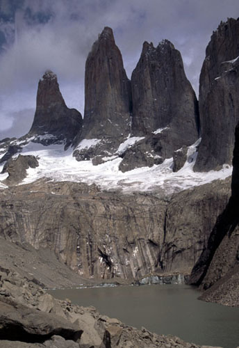
Torres del Paine. The cyclist has the option of a beautiful back route to/from Torres del Paine. Turn left about 12km north of Puerto Natales following signs to Cueva del Milodón. After the cave keep straight on the whole way. At about km40 you have to climb over a locked gate with a "Privado" sign (but no one worries about cyclists going this way) and the gravel road becomes a rough track which will have you off and pushing in places. At km70 (its probably day 2 by now) you reach the Río Serrano, where the broken bridge has been rehabilitated as a dodgy footbridge - you might care to make discreet enquiries in Puerto Natales as to its current state; recent reports suggest it survived the major floods of 1998. The Pehoé campsite is CH$ 8,000 per site (1997/8), so better to carry on to Las Torres which is CH$ 2,000 per person (sane price for once!) with hot showers (1997/8). The Río Serrano campsite is also reportedly a reasonable price (2km west of the broken bridge). Using this route, perhaps no one will notice whether you have paid your park entrance fee (CH$ 6,500 in 1997/8). The main park walking trails (dont even think of taking a bike) have become much more obvious since I first visited Torres del Paine in 1992, so the main treks are now all pretty straightforward, with the exception of the pass (1400m) on the full circuit, which is prone to snow all year. You can hire a backpack and other equipment in Puerto Natales if you want to go trekking. A basic trekking map is available locally. Be prepared for bad weather at any time of year (eg snow, gales, floods) on the trekking routes. It is physically possible but illegal to take a shortcut on a bicycle to the Perito Moreno Glacier in Argentina via the Paso de Zamora (see the Argentinean ACA map of Santa Cruz). There are no border guards. Sometimes cyclists get special permits to use this route without too much fuss, but most seem to run into a bureaucratic dead end. It seems you have to know who to ask. But should you accidentally "get lost" in this area and find yourself in the wrong country without the right stamps in your passport, then it is probably best not to own up to the authorities, but rather discreetly get back to the right country.
Back
road to Torres del Paine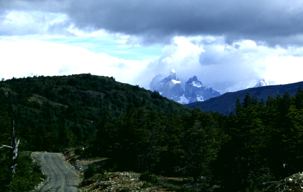
Midsummer
trekking in PN Torres del Paine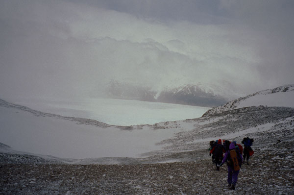
Tierra del Fuego. I found the gravel roads in excellent condition, apart from the road from San Sebastián to the Punta Delgada ferry which is heavily used by Argentinean lorry traffic. The back road from Porvenir through the Cordón Baquedano is also a bit rough, but it is a worthwhile shortcut with excellent views, and the 500m climb is easy enough with the wind behind you. With hindsight, I wish I had carried enough food to be able to do the loop down through Cameron and Lago Blanco, as the scenery apparently gets really interesting as you go further south. There is a hotel (not cheap) and restaurant (reasonable) at San Sebastián, though wait until the Argentina border post to refill your water bags as the water isn't potable on the Chilean side. If you were lightly loaded and had a well padded wallet, you could do Porvenir to Ushuaia without a tent, though this would be very difficult in the reverse direction because of the wind in your face. Whatever the maps say, there are no border crossings in the area south of San Sebastián.
Austral Chile (Aisén, XI Región)
North
Patagonian Ice Cap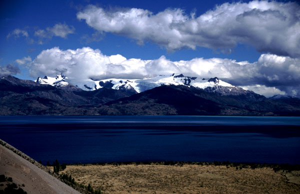
This is the most glorious area of all Chile for cycle touring. In most areas, the climate is comparable to the west coast of New Zealand, so expect lots of rain, but with even greater rewards than that wilderness. In a normal year, Nov/Dec has the least wet weather. It is also notably drier in more easterly locations such as Chile Chico, Cerro Castillo, etc. However wait for the occasional El Niño year, and you may be rewarded with a long (relatively) dry summer, following a cold wet spring. Come the autumn, torrential rain sets in again, and the passes are blocked by snow in the winter. The area is not immune to strong Patagonian winds, but they are rather less strong than on the Argentinean plains. When I went there, there were only 120km of paved road in the entire region, Puerto Chacabuco to Balmaceda. But things are changing. Paving has started on the main Chaitén to Puerto Aisén road, and apparently they plan to do the whole thing over the next few years! Moreover, the road has been paved from Coihaique to Villa Cerro Castillo, though there are no immediate plans to extend that further south. However, if you get there in time to enjoy the gravel, the main section was getting regular maintenance in 1997/8, so it is reasonable to plan on about 60-80km a day; elsewhere 50km might prove enough.
Navimag and Transmarchilay both run a ferry service Puerto Montt-Chaitén (9 hours) Chaitén-Quellón (5 hours) and Quellón-Puerto Chacabuco (20 hours). Each runs only once or twice a week, and the two companies do not co-ordinate timings, so it is worth finding out in advance when they go, and if necessary, book. They are cheap, but there is a stiff bike charge, which Navimag is more prone to overlook than Transmarchilay. If its busy, you are better off with Transmarchilay who give you a reserved coach-like seat; but on Navimag you can spread a sleeping bag out on a bench or the floor provided there isnt too much competition for space. Note also the new Navimag Puerto Montt-Puerto Chacabuco-Puerto Natales service mentioned above. The Laguna San Rafael is a major tourist attraction accessible only by boat - its rather cheaper to go on an excurrsion from Puerto Chacabuco than a cruise from Puerto Montt. The ferry from Hornopirén to Caleta Gonzalo (5 hours) only runs in the Jan/Feb holiday season. Currently Caleta Tortel is connected to the road system by a twice weekly boat to Puerto Yungay, but it is allegedly intended to build a road. If you are very lucky, you may be able to persuade a freighter carrying road-building supplies to take you from Puerto Yungay or Caleta Tortel to Punta Arenas, possibly a bit easier in the other direction. Out-dated ferry routes are still shown on some maps.
Principal air access to the zone is by flight from Puerto Montt to Balmaceda, 60km from Coihaique by hilly paved road. Flights tend to arrive in the evening so bring something to eat and plan to wild camp (theres a good spot by the river at El Blanco 20km away). I'm told you might find some food/accommodation if you leave the road and wander around Balmaceda village, though to me it looked more like a military camp than a village. Another possibility is to fly to Perito Moreno in Argentina, a short distance from Chile Chico. There are also infrequent light aircraft services to principal villages with hubs at Puerto Montt and Coihaique town airport. There are buses from Coihaique to Comodoro Rivadavia in Argentina, and also from Los Antiguos (near Chile Chico) to Caleta Olivia. Direct buses from Coihaique to Puerto Montt and Santiago run via Argentina, but there are minibus services from Coihaique to Chaitén and Chaitén to Futaleufú. There are coach services from Coihaique to Cochrane and Puerto Ibánez, also minibuses from Chile Chico to Cochrane, changing at Puerto Guadal. For connections to Magallanes, see above.
Puerto Montt to Chaitén via Hornopirén. The northern section of the Carretera Austral is one of the most beautiful and also one of the roughest. It is only passable in the Jan/Feb peak holiday season when the Hornopirén-Caleta Gonzalo ferry runs, though Hornopirén is accessible from Puerto Montt all year. The completion of the road shown on many maps from Caleta Puelche to Puelo has been delayed, and it remained impassable in 1997/8.
Near
Futaleufú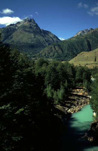
Chaitén to Coihaique. This is the busiest, best maintained and rainiest section of the Carretera Austral. Even though the highest pass is only 650m (near Villa Santa Lucia), expect a hard, hilly ride - so long as it remains unpaved. In Feb 2001, there was about 10km of pavement at Chaitén and about 10km at Villa Mañihuales. The official plan is to do the lot in the next two years, but experience suggests it will take rather longer than that. Go there now before there are lots of lorries and coaches driving up and down. There are basic supplies at Villa Santa Lucia, La Junta, Puerto Puyuhuapi, Puerto Cisnes and Villa Mañihuales. The short detour to Termas El Amarillo (camping possible), open again in 1997, is recommended. The rough side-route to the beautiful little town of Futaleufú is to many people even more attractive than the main road, and has the advantage of providing a connection to the attractive southern area of the Argentinean Lake District. Other eastern side routes to Palena, La Tapera, etc, are less interesting. There is a network of loops around Coihaique which make interesting detours.
Coihaique to Cochrane and Chile Chico. Arguably the most amazing area of all southern Chile is to the south of Coihaique. Here you pass through the transition zones between steppes and rainforest, thus getting a greater variety of scenery and more sunshine, as well as the expected jagged peaks and glaciers. There are two ferries across Lago Carrera running at least daily (for some reason people were disinclined to admit the existence of one of them) from Puerto Ibáñez to Chile Chico, providing the possibility of a circuit and an excellent short holiday tour. Whatever you do, do not miss out on the stunning road along the south shore of Lago Carrera (see photo above), an exceedingly rough and hilly road, but with amazing views of the northern ice field and jagged mountains, and lots of sunshine. The Río Fachinal, (only 45km W of Chile Chico but a full days ride for me) provides the only possible campsite and water supply for a considerable distance, so plan on a night there. There is also an excellent wildcamp 400m down a rough track on the E side of a river 5km west of Mallín Grande. Supplies and lodgings at Chile Chico, Puerto Guadal, Puerto Tranquilo, Puerto Murta, Villa Cerro Castillo, Cochrane and Puerto Ibáñez. Camp sites are hard to find between Villa Cerro Castillo and the 600m pass Cajón Cofre, because you ride along a shelf through a flooded canyon. Heading north out of Villa Cerro Castillo you climb the Cuesta del Diablo to the Portezuelo Ibáñez; at a modest 1120m it is the highest point on the Carretera Austral. As noted above, the Cuesta del Diablo is now paved. The side-route to Puerto Grosse (85km) has been completed. The detour to camp up at Lago Leones, which has a serac-covered glacier feeding it, was strongly recommended to me, but I had mechanical problems.
I am grateful to Richard Pash
(pottypashes@yahoo.com) for the following distance chart.
| Place | Leg | Total | Road | Comment |
| Chaitén | 0 | Ferry from Quellón irregular- check dates before arriving in Quellón! | ||
| Villa St Lucia | 78 | 78 | Unpaved | First 12km is now paved (2001). Road flat but with loose stones to Amarillo (25km) where there is food/accom, then better to Lago Yelcho/Puerto Cárdenas. Steep climb from km 65-72 then downhill again to Villa SL . (Jct for Futaleufú/ Palena/ Trevelín) |
| La Junta | 70 | 148 | Unpaved | Easy day: mostly downhill on good roads. Playa Negra @30km food and accom |
| Puerto Puyuguapi | 45 | 193 | Unpaved | Flat(ish) road, last 5km downhill. Conaf Campsite @ 28km ($4000/site). Puyuguapi v. nice |
| Campsite | 29 | 222 | Unpaved | Lovely wild campsite on Seno Ventisquero at 29km from Puyuguapi. Small beach just before reedbeds oppositetwo houses |
| Villa Amengual | 60 | 282 | Unpaved | Hard cycling more than made up by glorious scenery. Flat for 12km then climb 15 steep switchbacks (8km)to top. Descend steeply and follow undulating road to Villa Amengual |
| Villa Mañihuales | 58 | 340 | Unpaved | Flat/undulating last 8km on tarmac |
| Coyhaique | 86 | 426 | Paved | Gradually downhill to junction with PuertoAisén road then gradually uphill. After tunnel @ 70km climb for 5km then down to Coyhaique |
| Villa Cerro Castillo | 97 | 523 | Paved | First 41km undulating to turning then climb to km60. Descend 8km then further climb to km80 (1120m pass). Then descend steeply to jxn for Pto Ibáñez and continue descent to Villa CC. Excellent roads and gradual ascents make this an easier day than expected (he probably had a tail-wind - I.V.) |
| Campsite | 68 | 591 | Unpaved | First 20km on bad roads over hilly ground then on excellent roads for rest of the day. km20-40 flat in large valley then climb gradually to pass at 60km. Sharp descent to river's edge at 68km. Camp by river next to disused hut |
| Campsite near Puerto Rio Tranquilo | 61 | 652 | Unpaved | Descend to lake on bad roads then undulating by lake shore to Puerto RT (food and accom). We camped 6km after (take track to left at the col at 6km S of Pto RT follow to track end for incredible lake views) |
| Puerto Bertrand | 62 | 714 | Unpaved | Dreadful corrugated roads but breathtaking views of N Patagonian Icecap and surrounding mountains. Puerto Bertrand is lovely. |
| Cochrane | 49 | 763 | Unpaved | Short but hilly. Easy for first 15km then series of small steep hills until Km30. Traverse hillside and down to Cochrane |
South of Cochrane. Even fewer people head down the long road south of Cochrane. I didnt but I met someone who did. There are basic supplies at Caleta Tortel (made famous by Prince William's visit), accessible by 4 hour motor boat ride from the military camp at Puerto Yungay: recent reports suggest that the original twice-a-week service now runs daily, though perhaps that's only in summer. There are faint possibilities for picking up a freighter from there to Punta Arenas. The road to Villa O'Higgins opened in 1999, and this is a beautiful route. There is a ferry over the Estero Mitchell at Puerto Yungay, which may run a couple of times a day. Basic supplies are available at Villa O'Higgins. It is possible to get to Argentina from Villa O'Higgins, though the methods which have to be employed are not to everyone's taste. There is no road or ferry. Hiring some horses for part of the way takes some of the pain out of it. If you are in for the adventure, then this is a much more interesting route to Calafate than following the Ruta 40 the whole way. Sounds like it would be trickier to do it coming North - you might have to do it without assistance. Until recently this was Villa O'Higgins' main route to the outside world. I am grateful to Matt and Nicole Deniston for the following instructions.
Once in Villa O'Higgins, ask for Florentino Gómez, a few short blocks east of the main plaza. He's not a man of many words, but strong & competent. We paid $10/day per horse. If it's just the two of you, you'll need 3 horses. We took off in the afternoon, rode to a refugio and camped. The next day we rode all day to the Chilean border station. We spent the night there. The next morning it got tricky. We didn't have a map and the carabineros hand-drew us a sketchy at best map. Ended up getting lost a lot, pushing the bikes 90% of the time and making a grand total of 8.7 km that day. The only real hints we can give you is to stay close to the river Mayer, but not too close as the ground gets very soft and marshy (swamp-like). Your first landmark is a rickety foot bridge crossing a tributary river that hits the river Mayer from the left. The footbridge is probably 1-2km up from the Mayer. After that, we pushed the bikes back down towards the Mayer and found a small trail up a rocky bank. Later the trail turns into a double track road. Much of the road cuts through a sparsely treed forest and then hits an open meadow. At this point the road curves around quite a bit and then re-enters a wooded thicket. Keep your eyes open for smoke from the Argentinean border station (on the other side of the thicket). It's about 12km between the two stations. From there, you have a number of creek and small stream crossings. If you have sandals, wear them for this section. After a while, the road kind of disappears and you get to ride through a massive sheep estancia. This was an incredible section. Beautiful. Behind you have epic views to the cordillera to the west. From the Arg border station I think it was about 100km to the ruta 40. After the sheep estancia, fill up on water as there's not much ahead. That night we stayed at Estancia Faldeos. Nice folks. The next day we hit the Ruta 40, got minimal food at Las Horquetas (no more than a truck stop), and rode another 50km (tailwind!) to a wooded grove (the only one around). There's a stream nearby.On to Calafate (Argentina). If you are intent on heading south down the dreaded Ruta 40 to Calafate (see my Argentina notes), you have, in addition to the Villa O'Higgins route, the choice of crossing at Chile Chico, or the even more remote Paso Roballos to Bajo Caracoles. If you take the latter route, the road via Lago Posadas is better and has supplies at Lago Posadas. The map shows a road to Roballos heading south out of Chile Chico but reportedly it only goes as far as the Reserva Jenimeini. This is allegedly very interesting, but the road is exceedingly rough and steep. There is another terrible road on the Argentinean side of the frontier from Los Antiguos which does go through to Roballos. Persons finding themselves in the wrong country (see Paso de Zamora) might like to note that in good weather the rivers between Los Antiguos and Chile Chico are easily forded alongside the lake shore.
Lake District and Chiloé (X Región)
Volcán
Osorno and Lago Llanquihue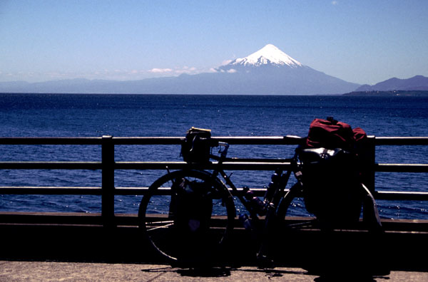
The Lake District is the most popular cycle touring area of Chile, particularly for shorter holidays. I think that its attractions are often overstated, at least from a cyclist's perspective. The lakes mostly lie in flatlands at the foot of the Andes, and you need to get to their heads for the wonderful scenery. These areas have better access for walkers than cyclists. There is certainly some wonderful cycling to be done, but it is mostly on the crossings to, or in, Argentina. Within Chile, you will ride a lot of bad roads through countryside similar to Leicestershire. Rainfall is generally similar to Scotland, but it can get very hot when the summer sun comes out.
The area becomes very full with chileno holiday-makers in Jan/Feb, especially early Feb, which makes riding the dusty roads rather tedious. Better to come in spring (October to December), which is normally a bit drier, or late summer (March). But in an El Niño year the spring can be cold and wet and summer dry and hot with good weather stretching into April. The unpaved roads are generally dreadful, becoming unridable when you have to cross patches of volcanic sand.
It is easy to get a bus from Santiago to any convenient destination in the area. Cross-border buses run from Puerto Montt to Bariloche via Osorno.
Puerto Montt to Bariloche (Argentina) using three ferries via Petrohué, Peulla, Puerto Frías, Puerto Blest, Puerto Alegre and Llao-Llao is popular, despite the high risk of rain and the cost. This is a tourist attraction, not public transport. Your bicycle will be charged at half the passenger rate. It is a bit cheaper if you do it from the Chilean side. I was quoted over US$100 including the bike from the Bariloche side. However paying for each of the ferries individually from the Chilean side, I have recently heard of people doing it for around $60. You will probably find it necessary to spread the crossings over two days; it is possible to camp in or near Peulla. If you wish to explore this interesting area, you may find it cheaper and more rewarding to go walking around Bariloche, and/or to make the walk from Cayutué to Ralún - small boats can be hired to take you from Petrohué to Cayutué. It is also possible to charter a small boat if you miss the catamaran at Petrohué, for the same price as tha catamaran. There is now a paved and quieter alternative (thank heavens) to the Panamericana between Puerto Montt and Puerto Varas via Alerce.
Panguipulli to San Martín de los Andes (Argentina) is recommended. It involves a lake ferry over Lago Pirihueico, which runs twice a day. If you miss the ferry, the track round the lake is very rough. The route via Enco is theoretically closed because the bridge at Enco has been abandoned. However you can ford the river in good weather, but you will find the road along the south of Lago Riñihue pretty rough. I know no one who has tried the Paso Carirriñe. The route due south out of Puerto Fuy to Futroño looks interesting but hard; there are two river ferries on the way.
Entre Lagos to Bariloche (Argentina) is a beautiful ride. The steep Chilean side of the pass was paved in 1998, but work is progressing slowly on the Argentinean side. A nuisance is the absence of anywhere reasonable to stay or camp between Entre Lagos and Villa La Angostura, which is about 115km; the cold tap Conaf campsite at Anticura is simple, unattractive, and very overpriced at CH$ 4,000 per site in 1997/8. I was so annoyed by the Conaf guy's attitude I suddenly found the energy to carry on.
Cochamó
Lago Llanquihue. The route around the east of the lake is attractive but hard work. The ride down to Ralún (paved) and Cochamó (unpaved) is highly recommended. The Puelo to Puelche road was still unbuilt in 1997/8, but its not quite a dead end....
Puelo to Puelo (Argentina). It is possible to ride (quite legally) from Puelo in Chile to Lago Puelo near El Bolsón in Argentina. It is a rough track and there are two river crossings (Río Puelo and Río Manso) where you will have to find someone to ferry you across. Or find a hardened kiwi biker who can show you the old tractor inner-tube trick. (What, don't you carry a tractor inner-tube? What kind of a pansy biker are you?) Carlos Vlaene at El Bolsa del Deporte, Palacios 405 (corner of Elflein), Bariloche, Argentina (a recommended hostel), runs organised mountain bike treks on this route, and may be a source of information.
Palafitos
on Chiloé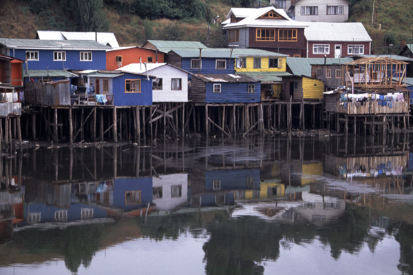
Chiloé looks remarkably like a preserved corner of Ireland or Cornwall. Unlike most parts of Chile, it has a distinctive culture and cuisine, and lots of wildlife. Many tourists like to spend a relatively relaxing few days here, eating curanto and salmon. It can be terribly wet. The local Spanish dialect is incomprehensible. It is worth visiting an off-shore island such as Lemuy, but as usual expect all unpaved roads to be terrible. The road out to Cucao is also attractive. Esmeraldas at Chonchi is a lovely place to stay. Beware the mad bike repairer with the squashed nose in Ancud.
Monkey
puzzles in the snow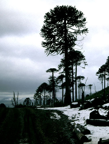
The conjunction of volcanoes, monkey puzzle trees, the steppe zones on the frontier, and the Mapuche culture make something which is to me altogether more interesting than the Lake District. Moreover this area is less visited, more unspoilt, and indeed poorer than the Lake District.
General details are much as for the Lake District. There is a cross-border bus service from Pucón to Junín and San Martín de los Andes. In 1998 there was still a train service from Santiago to Temuco (and no further). Others have got a bike on this train, but I failed.
Lonquímay and Icalma. This area is the essence of the zone. You have to hitch through the Las Raíces tunnel - it is a single track unpaved tunnel with 45 minute slots in each direction. (Recent reports suggest that there is now a hostel run by Swiss cyclists near Malalcahuello, not to be confused with a similar institution at Villarrica.) The road east from Curacautín was paved as far as Sierra Nevada in 1997/8. I found the road via Lago Galletué not bad by Chilean standards - this area has recently been declared a reserve. There are interesting Mapuche settlements around Icalma. The map omits to show several roads around Icalma and Galletué, which makes navigating tricky; if you accidentally reach the Mapuche village of Marimenuco, as I did, then you are on the main Icalma to Pino Hachado road. From Icalma to Melipeuco the road is very bad but worth it (recent reports suggest it has been upgraded). A few cycle across the PN Conguillío, and find the volcanic soil makes for hard riding. There are several new reserves to the NW of Lonquímay so this area might be worth exploring too. You may have to improvise when it comes to passing the night around here.
Mapuche
fields on Lago Icalma
Pucón to Coñaripe via Termas de Palguín. A very rough, steep and scenic pass at about 1250m. Excellent free campsite just to the north of the summit, and another shaded free site just to the south with a possibility of walking up to the glacier. Easier tackled from the north. On the way up there are a couple of big waterfalls a short distance off the road. When you get to the entrance to Termas de Palguín fork left signpost "Parque Nacional", and follow similar signposts further on. The road comes out right into the centre of Coñaripe, not as shown on the map. There are a few barbed wire "gates" to open on the way. From Coñaripe, ask in the village for the road to Termas de Palguín; don't follow the signpost to a different Termas you will see on your way up. This side of the pass can be rather muddy.
Pucón to Junín de los Andes (Argentina) is a lovely crossing, with close-up views of the largest volcano of the zone, Lanín. The pavement should by now have been extended from Pucón to Curarrehue. There is a free camping area with no facilities by the river at Curarrehue (supplies in the village). The road was bad from Curarrehue to the border post, but the climb up the pass has been improved. There is a beautiful simple campsite (small charge, popular at weekends) at Lago Tromen just east of the Argentinean border post, 2km down a rough track and over a ford. The road on to Junín is rather soft in places, so dont expect to make fast progress.
Valdivia Bird-watchers and botanists will be pleased to visit the pleasant germanic university town of Valdivia and the surrounding area. To Chilenos it is famous for its rain. There are two connections to the Panamericana, but to the north and south lies a little-known network of very rough, hilly unpaved roads.
Parque Nacional Nahuelbuta lies between Angol and Lebú, and has a rough crossing at about 1,400m which was recommended to me, but I didnt try it.
Valparaíso
This area stretching from just north of Santiago down to Los Angeles is usually thought of as a region to get across as fast as possible rather than touring terrain. However this is the Chilean heartland, and anyone with time on their hands who wishes to see the "real" Chile should spend a little time here. It is best in spring and autumn as summer is hot and winter is cold.
Only a masochist will cycle south out of Santiago - some bus assistance if only to Melipilla or Rancagua will avoid much unpleasantness. Cycling down the Panamericana has nothing to recommend it - a busy dual carriageway passing though flat farmland and industrial cities, with views of the Andes mostly obscured by smog or foothills. There is no through route east of the Panamericana until you are almost in the Araucanía. Although the area includes some of the highest and most magnificent sections of the Andes, they are not convenient to visit. Most routes into the Andes here are long dead ends, often on terrible unpaved roads. If you have time on your hands, the following are said to be worthwhile: Cajón de Maipó (the paved road goes quite a way, but you will have a big climb on an unpaved road if you want to walk to the glaciers), Termas del Flaco (has dinosaur footprints), Radal Siete Tazas. The ski resorts near Santiago have a paved access road, and the scenery on the way up is worth the effort. Paso Pehuenche (2,550m) is a challenging but usable route from Talca to Malargüe in Argentina, which can be open when the main pass to Mendoza is closed.
Along the coast is delightful countryside with lovely beaches, reminiscent of Galicia and Portugal. Not something worth travelling around the world for, but very enjoyable if you are in the area and have the time. Give it a miss in Jan/Feb as the the beach resorts will be crawling. Unfortunately there is a gap in the paved road network along the coast from Pichilemu to Constitución. You will either have to suffer some terrible tracks for two or three days, or take some buses via Talca. There is a plan to build a complete paved coastal route, but it will take decades. Constitución is a must-visit for bird-watchers. The road south out of Constitución is lovely, with the interest of seeing the rapid change from the Mediterranean landscape of central Chile to the green south as you cross the Río Itata. After the coal towns, such as Concepción and Lota, the coastal roads become an unpaved adventure again. But there is a paved route through Angol (with the possibility of taking in the Parque Nacional Nahuelbuta) which keeps you off the Panamercana most of the way to the Araucanía.
Climbing
towards Mendoza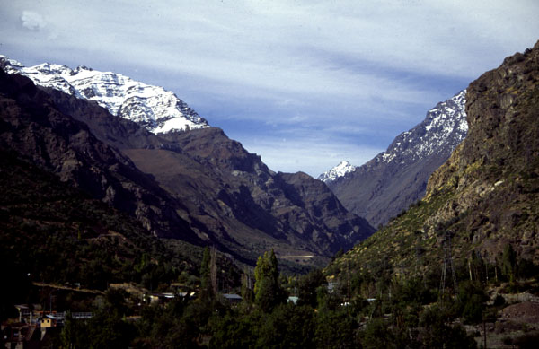
Santiago to Mendoza (Argentina). This route is unmissable. The 4km tunnel is at 3,185m, and the tunnel guards will bus you through. Normal human beings will need a camp on the way up; there are plenty of wild-camping possibilities once you pass the checkpoint at Guardia Vieja at about 1600m. The pass is kept open all year, but is periodically blocked for a couple of days during snowfall from about April to September. If you want to climb up to the Cristo Redentor statue at 3,863m, it is accessible via a track from the Argentinean side until the first autumn snowfall. On the Argentinean side, there are plentiful wild camping possibilities, and also accommodation (not cheap) at Las Cuevas, Puente del Inca and Los Penitentes, all within an hour of the top (if you are going down). Further on, there is accommodation at Punta de Vaca and full services at Uspallata. See my Argentina notes for the range of fascinating options from Uspallata. If arriving from Chile to climb Aconcagua, you should go down to the border post at Puente del Inca to have your passport stamped first. I crossed the pass in late April. It was well below zero and there was a lot of snow, though apparently this is not usual at that time of year. There is a system of check-points on the way down where all vehicles, including bicycles, have to get a stamp.
Vicuñas
in PN Lauca at 4,500m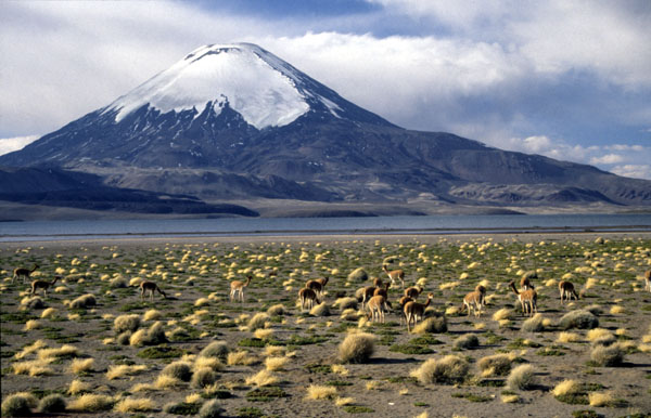
You can ride through the Atacama desert. Its not as hard as it sounds. You can go the whole way on paved roads if you want. Water is available more frequently than you might imagine, though you will quickly acquire the routine of putting 10 or 15 litres on your bike. Even the main Panamericana is not terribly busy once you get out of the populated zone around Santiago. Its sometimes very hilly - drops into canyons 1,000m deep are a regular occurrence in some zones, though climbs are generally gentle. There are certainly many interesting areas, but on the whole the Atacama is rather less colourful than, say, the NW Argentinean desert. The monochrome views can get exceedingly monotonous, so it is best to determine whether you have a suitably meditative temperament before committing yourself to a six-week tour. You can always jump on a bus to get over a long boring bit.
It is best to avoid midsummer in the area, as it becomes unpleasantly hot away from the coast. By the sea, it doesnt get terribly hot at any time of year because daily fogs (camanchaca or garúa) keep off the morning sun and temperatures down. Inland, days can be scorching and nights exceedingly cold, so make sure you have equipment suited to your route. There is often a stiff breeze coming from the west. North of Copiapó, rainfall is essentially zero and nothing grows, though localised freak downpours can occur. Between Copiapó and Santiago, there is a bit of rainfall in the winter, and if there is enough the valleys can be carpeted with flowers around mid-September. Finding a campsite is rarely a problem. Many places are so dry that the main value of a tent is to keep the dust off.
Tocopilla
If you leave the paved roads and climb up into the high Andes, then you have embarked on serious expedition cycling. Until you have acclimatised, altitude is a very serious issue (see above). The roads can be unridably soft. Water becomes an all-consuming concern, though above about 3000m you leave the Atacama and rainfall and surface water become more common. Choosing your season is tricky in this area. The summer is the wet season in the high Andes and storms bringing flash floods are a serious risk; winter is the dry season, but it can be very cold and in more southerly areas a late snowfall might block the route for the season (this happened to the Paso del Agua Negra in 1998). For more information, visit Eric Savard (see above), who has a detailed account by a strong Austrian cyclist who made a high altitude tour.
La Serena. The Elqui valley is one of the more interesting and straightforward areas to tour, green and lush due to a river coming down from the Andes. The more adventurous can make an interesting loop though Ovalle or Andacollo.
Antofagasta to Iquique. The coastal route is now fully paved and has become the "main road" replacing the inland Panamericana. With views of the coastal ranges rising straight from the sea to 2,000m, it is more interesting than riding the inland route over the pampa. Tocopilla is a picturesque town, with many of the original painted houses still surviving.
Atacama
Desert near Calama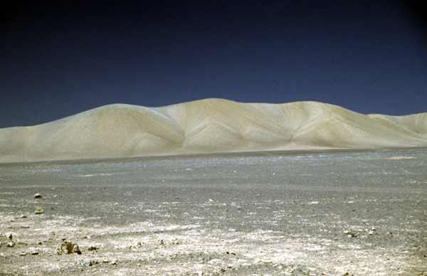
San Pedro de Atacama(2,400m) is a deservedly popular destination. The 1,100m climb from Calama to the 3,300m Cuesta de Barros Arana is gentle, rather stiffer on the way back. There is a tree on the way. You can ride up to El Tatio geyser field provided you are confident about the altitude (max 4,200m). Allow at least three days for the round trip. Termas de Puritama (water) is 30km from San Pedro just off the El Tatio road, to me this was the best bit, though they are to start charging an entry fee. There is water at the ford of the Río Grande 70km from San Pedro, this would be a good camp for the first day. You need to camp at El Tatio and get up before dawn for the best views, dont expect solitude. The water at El Tatio is poisonous due to arsenic. Dont go close up to the hot pools, people have died when overhangs collapse. Some cyclists feel the need to ride one of the routes from San Pedro to Uyuní in Bolivia. This is a serious expedition. See my notes on Bolivia.
Arica to La Paz (Bolivia). This remote ribbon of paved road, paved the whole way to La Paz since 1997, is an excellent way of leaving Bolivia for Chile. The PN Lauca is unmissable, with more wildlife than you will generally find on the Bolivian or Peruvian altiplano. It is a very tempting way of leaving Chile for Bolivia, but think twice before starting the climb. Altitude is a serious issue: it climbs to 4,400m in only 160km before crossing the border at 4,667m, with only Putre (3,500m) as a sensible acclimatisation stop. I have heard of cyclists having to sit out three days sick in a tent because they climbed too fast. There is probably 1,000-1,500m more climbing than the headline figures, as there are some major undulations once you get above 3,000m. For more details, see my Bolivia notes.
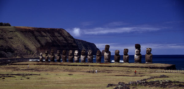
Rapa Nui, Isla de Pascua or
Easter Island is an integral part of Chile, but the culture is Polynesian.
Rapa Nui, a language closely related to Maori and Tahitian, is still spoken,
but everyone can speak Spanish. It could not be described as a cycling
destination in itself, but a bicycle is ideal transport for visiting the
island. Everywhere is within a return day ride of Hanga Roa, the only settlement,
but rather too far to walk. There is no public transport, and hire cars
and tours are expensive. You can hire a reasonable mountain bike. The 20km
road to Anakena, where there is a lovely beach, is paved. Other roads are
earth tracks. Whilst not too bad by Chilean standards, they become impassable
after heavy rain.
The only way to get there is on LanChiles Santiago-Isla de Pascua-Tahiti run, which has a code-share extension to Auckland and Sydney with Air New Zealand. A return from Santiago to Isla de Pascua costs about US$800 (1998), but sometimes there is a good discount in the low season (April to June). The airport is within walking distance of Hanga Roa.
The currency is the Chilean Peso, though dollars are widely accepted. You generally get a better price in pesos, except for things like accommodation and tours which are priced in dollars. Prices are 50%-100% higher than in mainland Chile. Shops are well stocked; you can even get white gas (bencina blanca). Camp cooking isnt a bad idea as meals out are pricey and not special. Supplement your diet by collecting wild guavas (guayabas), ripe when the flesh turns pink. Accommodation starts at US$12, though you can camp at Ana Rapus place for US$6. There is a free campsite at Anakena, but its not much use on a bike as there is no water. Wild camping is not allowed, though next to Rano Raraku crater lake would be a nice spot.
The climate is comfortable marine sub-tropical. The average temperature varies from 17C in August to 23C in February. Day/night temperature difference is only about 6C to 8C, and there is never a frost. It rains pretty regularly year round, though April to July is rather wetter. It is frequently overcast, though it often clears up for a sunset, or perhaps I was lucky. There is often a stiff breeze. Two hours behind Santiago, sun overhead is about 1300. For nice weather and limited tourists, September/October is a good time, but timing is not crucial. Five days is enough time to see everything without rushing, but you might easily want to stay longer, either to insure against the risk of rain or just to relax. "Sharing" is part of Polynesian culture, so keep an eye on your valuables. A child might borrow your bike, but it will come back.
Ivan Viehoff, Updated August
2001
